Detroit tram map
You can find on this page the Detroit tram map to print and to download in PDF. The Detroit trams map presents the network, zones, stations and different lines of the tramway of Detroit in Michigan - USA.
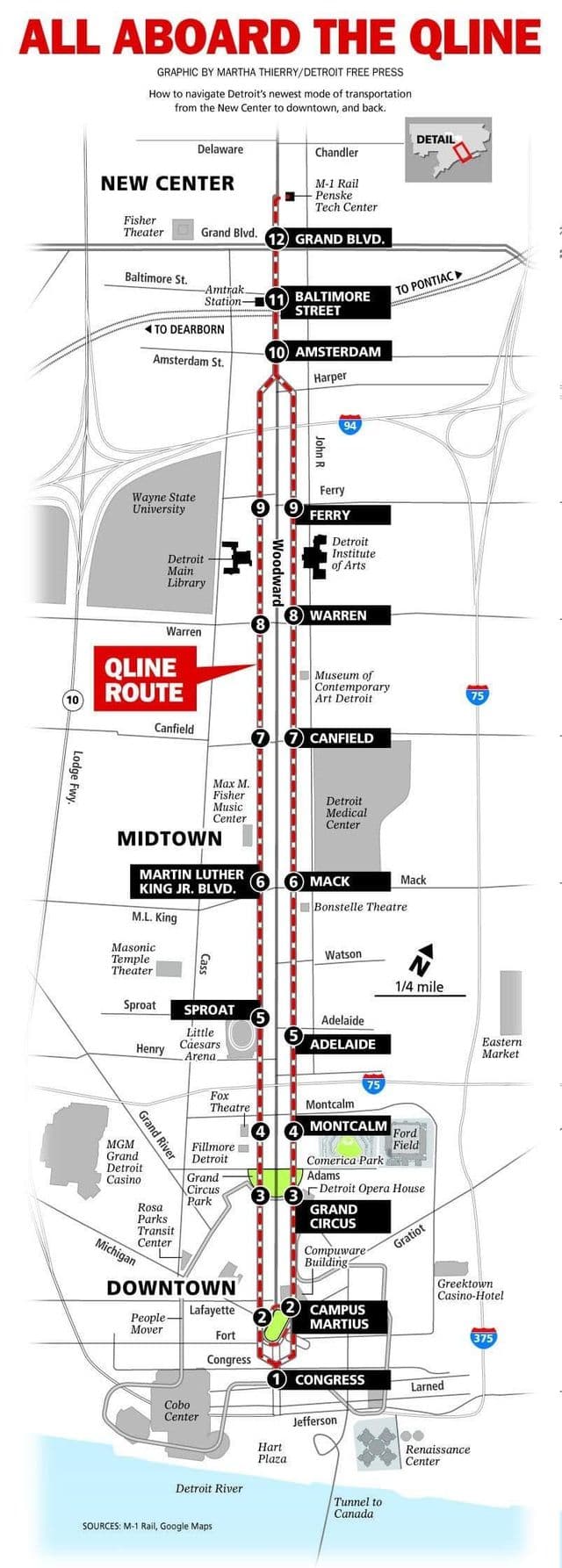
Detroit tramway map
The Detroit tram map shows all the stations and lines of the Detroit tramways. This tramway map of Detroit will allow you to easily plan your routes in the trams of Detroit in Michigan - USA. The Detroit tram map is downloadable in PDF, printable and free.
Although Detroit is known the world over as the Motor City, it has always had public transportation and it used to be really good. It was slow going on Detroit muddy streets until rails were built. The first streetcars, which were pulled by horses, began service in 1863 (see Detroit tramway map). By the 1890s, all lines were electrified which sped things up significantly. In 1922, Detroit purchased the streetcar lines from the Detroit United Railway, a privately owned company, making Detroit the first large American city to own and operate its own transit system. Its mostly been downhill since then. In 1956, the last three remaining streetcar lines in Detroit were discontinued and replaced with buses despite objections from many streetcar riders. The streetcars were less than 10 years old.